Free Union
|
Saunders Trail
|
UVa Track
|
Running in Charlottesville
There are dozens of quiet and scenic places to run in our beautiful neck of the woods and here’s just a sampling of our customer’s favorites…
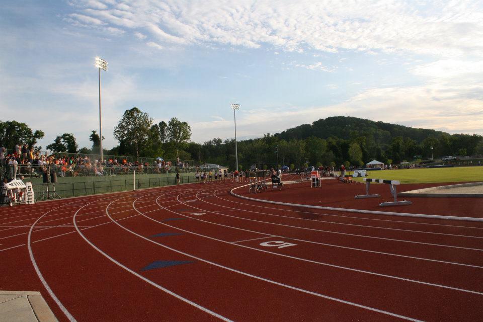
Our Community Tracks — Our area has over a dozen community school tracks of varying distances open to the public (non-school hours). We have measured each of these neighborhood venues and have assembled a list of them for your running enjoyment and convenience. All of the high school tracks (not included below) are the traditional 4 laps to the mile and have a rubberized surface.
Keene — A seven mile loop of gravel road in the southern part of the County. Take Route 20 South to Keene and turn left on Coles Rolling Road and then make a right on Glendowner. Park at Christ Church on the right (except on Sundays).
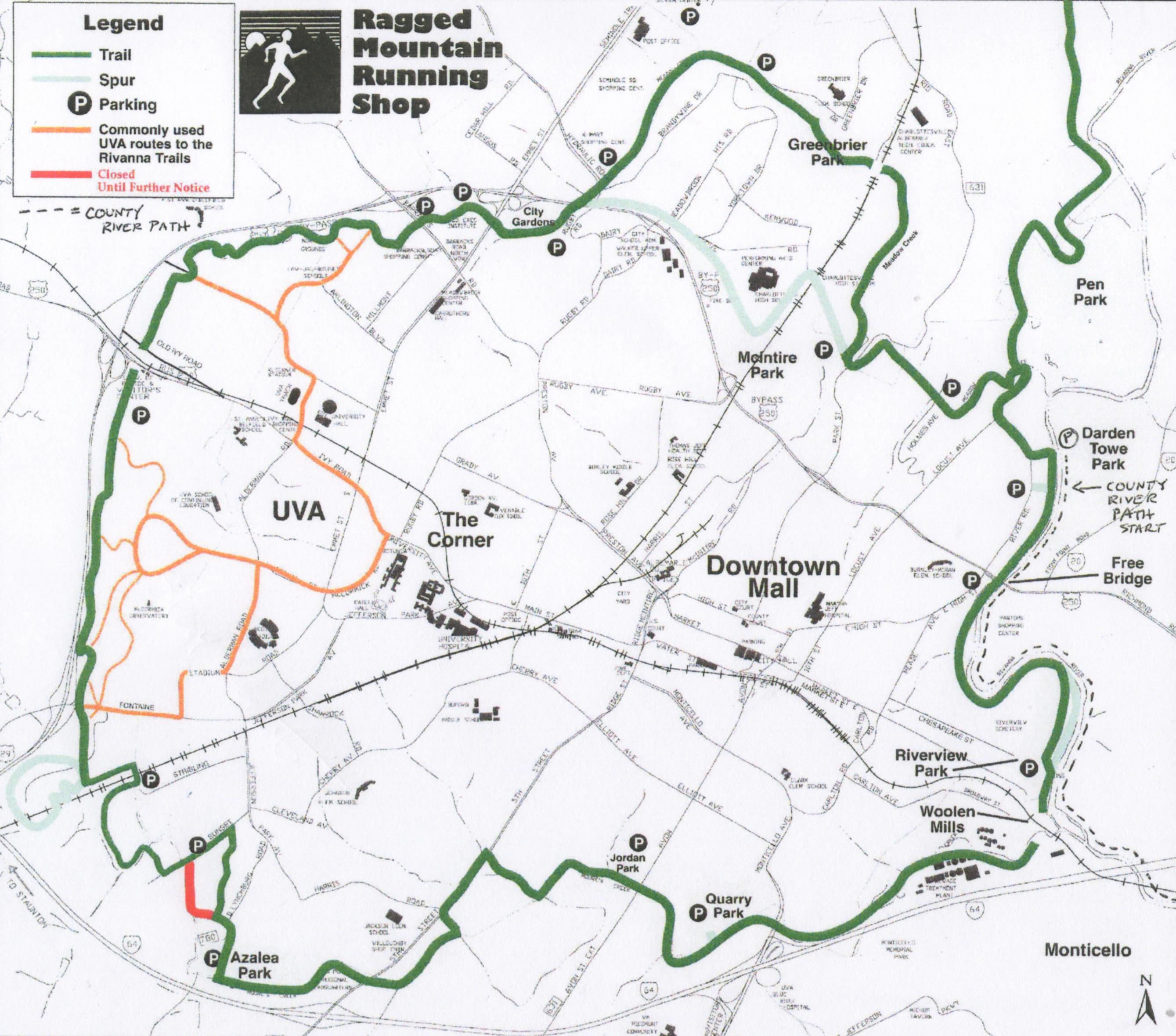
The Rivanna Trails (RTF) — Charlottesville is home to one of the nation’s best urban trails systems, an almost completely uninterrupted 20 mile loop of soft surface paths that circle the city. The fine folks at the RTF have been volunteering their time throughout the year since 1992 to create and maintain this wonderful network of trails. A detailed hard copy pamphlet map of the entire RTF path system is also available for free at Ragged Mountain. Many thanks to all of our community neighbor property owners along the path.
Sugar Hollow Dam — Located at the base of the Blue Ridge Mountains in the far western part of Albemarle County, this beautiful area has numerous options for scenic and peaceful running. From the parking area above the dam, one can cross the stream and head southwest up the side of the mountain along a wide and soft fire trail (the famous “Blue Hole” swim area is located along this trail) for several miles. It’s almost exactly 4 miles from the parking lot to the Appalachian Trail, and another 200 meters past that to the Blue Ridge Parkway. For a different trail run, proceed up the gravel road heading Northwest out of the parking area to the narrow single track path. This path leads you across the stream several times, and eventually makes its way to the top of the mountain and Blue Ridge Parkway. Head back down the paved road away from the dam and you can log 5 miles of scenic running, following the river east, before you arrive in the village of White Hall. Turn around and head back towards the dam and take a right on Sugar Ridge Road and within a mile you’re soaking in the breathtaking scenery of Whitehall Vineyards.
Historic Green Springs — A jewel of a 14,000 acre secret with close to twenty miles of quiet, soft surface roads and only minutes from Charlottesville! Take 64 East to the Route 15 exit, turn left on 15 North and follow for ~2 miles. Look for East Green Springs Road on your right. Follow East Green Springs Road for about 2 miles and park at the Chapel on the left.
Riverview Park — This RTF section of “magic pavement” is the flattest and quietest two mile section of blacktop around! Thanks to the kind donation of marathoner Nick Wispelwey, Ragged Mountain has placed brown stained pressure treated posts every quarter mile along the "lower" river path for your training convenience. Take Chesapeake Avenue (off Meade) to Riverview Park.
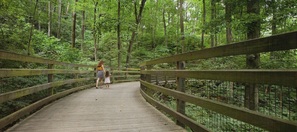
The Saunders Trail to Monticello — Opened in the mid-nineties, this popular public crushed gravel path gently meanders, for two scenic miles, up the base of Carter’s Mountain, past the historic Michie Tavern to the gates of Jefferson’s famous and beautiful “Monticello”. Parking is available at the base of Route 53 (take a left off Route 20 south…about a quarter of a mile from the 64 overpass and across from PVCC).
Charlottesville Ten Miler Course — Widely considered to be one of the most scenic urban race courses in the country, this hilly but beautiful historic tour of the city and university grounds is used each spring for the area’s oldest and most revered footrace. Park at University Hall and start close to the base of Massie. A detailed map is available at Ragged Mountain.
All of the County Parks — Once thought of as swimming, softball and soccer venues, our system of Albemarle County parks now features endless miles of scenic and peaceful soft surface footpaths. Mint Springs (west), Walnut Creek (south), Chris Greene (north), Preddy Creek (north), Humphris (northern urban ring), Totier (far south), Byrom (northwest), Towe (northeast) and the Historic River Greenway Path Park, which will ultimately take foot travelers on a ten mile riverside path from underneath Free Bridge southeast all the way to Fluvanna!
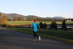
Free Union Runs — Many of our customers claim that the most gorgeous runs in our already beautiful county are to be found along the roads of Free Union. Start at Wesley Chapel Road and head in any direction and you’re in for a visual treat (Ballards Mill, Catterton and Spring Chapel are among our favorite roads in this beautiful hamlet).
Dick Woods Road — Another beautiful crushed gravel country road that travels up to 8 miles in one direction. Take 250 West to Miller School Road and follow for about 2.5 miles until you see Dick Woods Road on your right. The parking area is kindly donated and maintained by our friends at the Miller School of Albemarle.
Virtual Video Tour of Dick Woods Road
Camp Holiday Trails — This hilly but quiet and scenic run is the closest “dirt” road to the city limits. The road, which is currently being heavily utilized by large equipment building the new Ragged Mountain Reservoir, runs around 1.5 miles in one direction. Take Fontaine Avenue underneath the 29/250 bypass to Reservoir Road and turn right.
Download Local Running Maps (PDF)
Our Community Tracks — Our area has over a dozen community school tracks of varying distances open to the public (non-school hours). We have measured each of these neighborhood venues and have assembled a list of them for your running enjoyment and convenience. All of the high school tracks (not included below) are the traditional 4 laps to the mile and have a rubberized surface.
Keene — A seven mile loop of gravel road in the southern part of the County. Take Route 20 South to Keene and turn left on Coles Rolling Road and then make a right on Glendowner. Park at Christ Church on the right (except on Sundays).
The Rivanna Trails (RTF) — Charlottesville is home to one of the nation’s best urban trails systems, an almost completely uninterrupted 20 mile loop of soft surface paths that circle the city. The fine folks at the RTF have been volunteering their time throughout the year since 1992 to create and maintain this wonderful network of trails. A detailed hard copy pamphlet map of the entire RTF path system is also available for free at Ragged Mountain. Many thanks to all of our community neighbor property owners along the path.
Sugar Hollow Dam — Located at the base of the Blue Ridge Mountains in the far western part of Albemarle County, this beautiful area has numerous options for scenic and peaceful running. From the parking area above the dam, one can cross the stream and head southwest up the side of the mountain along a wide and soft fire trail (the famous “Blue Hole” swim area is located along this trail) for several miles. It’s almost exactly 4 miles from the parking lot to the Appalachian Trail, and another 200 meters past that to the Blue Ridge Parkway. For a different trail run, proceed up the gravel road heading Northwest out of the parking area to the narrow single track path. This path leads you across the stream several times, and eventually makes its way to the top of the mountain and Blue Ridge Parkway. Head back down the paved road away from the dam and you can log 5 miles of scenic running, following the river east, before you arrive in the village of White Hall. Turn around and head back towards the dam and take a right on Sugar Ridge Road and within a mile you’re soaking in the breathtaking scenery of Whitehall Vineyards.
Historic Green Springs — A jewel of a 14,000 acre secret with close to twenty miles of quiet, soft surface roads and only minutes from Charlottesville! Take 64 East to the Route 15 exit, turn left on 15 North and follow for ~2 miles. Look for East Green Springs Road on your right. Follow East Green Springs Road for about 2 miles and park at the Chapel on the left.
Riverview Park — This RTF section of “magic pavement” is the flattest and quietest two mile section of blacktop around! Thanks to the kind donation of marathoner Nick Wispelwey, Ragged Mountain has placed brown stained pressure treated posts every quarter mile along the "lower" river path for your training convenience. Take Chesapeake Avenue (off Meade) to Riverview Park.
The Saunders Trail to Monticello — Opened in the mid-nineties, this popular public crushed gravel path gently meanders, for two scenic miles, up the base of Carter’s Mountain, past the historic Michie Tavern to the gates of Jefferson’s famous and beautiful “Monticello”. Parking is available at the base of Route 53 (take a left off Route 20 south…about a quarter of a mile from the 64 overpass and across from PVCC).
Charlottesville Ten Miler Course — Widely considered to be one of the most scenic urban race courses in the country, this hilly but beautiful historic tour of the city and university grounds is used each spring for the area’s oldest and most revered footrace. Park at University Hall and start close to the base of Massie. A detailed map is available at Ragged Mountain.
All of the County Parks — Once thought of as swimming, softball and soccer venues, our system of Albemarle County parks now features endless miles of scenic and peaceful soft surface footpaths. Mint Springs (west), Walnut Creek (south), Chris Greene (north), Preddy Creek (north), Humphris (northern urban ring), Totier (far south), Byrom (northwest), Towe (northeast) and the Historic River Greenway Path Park, which will ultimately take foot travelers on a ten mile riverside path from underneath Free Bridge southeast all the way to Fluvanna!
Free Union Runs — Many of our customers claim that the most gorgeous runs in our already beautiful county are to be found along the roads of Free Union. Start at Wesley Chapel Road and head in any direction and you’re in for a visual treat (Ballards Mill, Catterton and Spring Chapel are among our favorite roads in this beautiful hamlet).
Dick Woods Road — Another beautiful crushed gravel country road that travels up to 8 miles in one direction. Take 250 West to Miller School Road and follow for about 2.5 miles until you see Dick Woods Road on your right. The parking area is kindly donated and maintained by our friends at the Miller School of Albemarle.
Virtual Video Tour of Dick Woods Road
Camp Holiday Trails — This hilly but quiet and scenic run is the closest “dirt” road to the city limits. The road, which is currently being heavily utilized by large equipment building the new Ragged Mountain Reservoir, runs around 1.5 miles in one direction. Take Fontaine Avenue underneath the 29/250 bypass to Reservoir Road and turn right.
Download Local Running Maps (PDF)